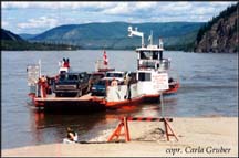
In Dawson we looked in a fellows little antique shop. He had a couple of common CDs in clear glass at a higher price than I was willing to pay. Dawson is a fun little town in the summer [If you like small towns]. There are a couple of good eateries and tourist shows if you are so inclined. There's a nice local history museum. Here's one of the phones used in an early homested. The people are friendly and I liked the ice cream shop next to the Yukon River. Later we road the government ferry, The George Black, across the Yukon to continue our tour. The next part would see us riding over the Top of the World Highway.
 Top
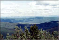
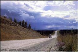
of the World Highway. At the time when this two-lane dirt road was
put in connecting northern Yukon Territory to Interior Alaska, engineering
was not as advanced as it is now. Instead of being able to cut into
the mountains, the road builders where forced to bring the road along the
tops, thus giving the road its name and a grand view of the curvature
of the earth from up there. Commo for this area is satellite fed
until you get to Eagle, Alaska. The
Top
of the World Highway. At the time when this two-lane dirt road was
put in connecting northern Yukon Territory to Interior Alaska, engineering
was not as advanced as it is now. Instead of being able to cut into
the mountains, the road builders where forced to bring the road along the
tops, thus giving the road its name and a grand view of the curvature
of the earth from up there. Commo for this area is satellite fed
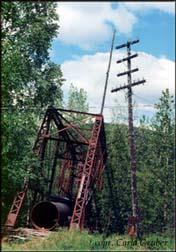
until you get to Eagle, Alaska. The 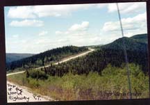 origin
of the Washington-Alaska Military Cable System [WAMCATS]. Eagle is
60 miles out from Chicken, Alaska on a washboard road. There,
they have a museum dedicated to Eagles place in the long distance communications
history of Alaska.
origin
of the Washington-Alaska Military Cable System [WAMCATS]. Eagle is
60 miles out from Chicken, Alaska on a washboard road. There,
they have a museum dedicated to Eagles place in the long distance communications
history of Alaska.